The best levada walk in Madeira depends on what you want from the day. Choose Levada das 25 Fontes for waterfalls, Levada do Rei for a longer forest walk, or Vereda dos Balcões for a short introduction without committing to several hours on the trail. Caldeirão Verde suits walkers comfortable with tunnels and a longer outing.
Do not choose by photographs alone. Distance, exposure, transport and the exact turnaround point matter more than how green a waterfall looks on your phone. This guide compares six worthwhile options; the broader Madeira hiking guide covers planning beyond the levadas.
How to Choose a Levada Walk
Levadas are water channels, with walking paths often following their maintenance routes. That explains the gentle gradient of many stretches, but not every part of the outing. Access paths, steps and the return to your starting point can change the effort involved.
Treat distance and comfort as separate questions. A longer forest trail might suit you better than a shorter path with a drop beside it. If darkness, narrow passages or heights make you uncomfortable, resolve that before booking transport rather than at the first tunnel entrance.
The distances below follow the IFCN classified trail listings and access notices. Check the current status before departure: a route appearing in this comparison does not guarantee access on your travel date.
| Walk | Walking distance | Choose it for |
|---|---|---|
| PR6 Levada das 25 Fontes | 8.6 km return | A waterfall focused first levada walk |
| PR9 Levada do Caldeirão Verde | 17.4 km return for the full route to Caldeirão do Inferno | Forest, tunnels and a longer walking day |
| PR11 Vereda dos Balcões | 3 km return | A short walk to a mountain viewpoint |
| PR18 Levada do Rei | 10.6 km return | A substantial forest outing |
| PR6.2 Levada do Alecrim | 7 km return | A shorter Rabaçal alternative |
| PR10 Levada do Furado | 11 km one way | A walk between different starting and finishing points |
Pay particular attention to “return” and “one way”. They are small words with a fairly large effect on lunch arrangements.
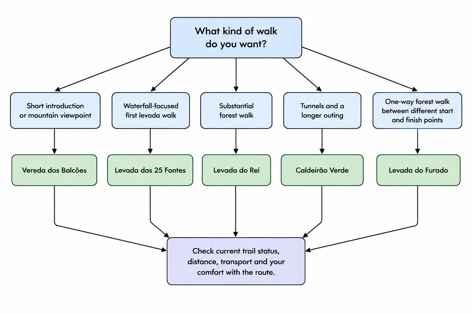
Levada das 25 Fontes: Best for a First Waterfall Walk
PR6 is a strong choice if you want one recognisable Madeira levada experience. The destination is a pool beneath a rock face threaded with springs, while the approach passes through the Rabaçal area. The Calheta municipality route information for 25 Fontes identifies the itinerary from ER105 through the Rabaçal buildings to the springs.
The official return distance is 8.6 km, with a moderate difficulty rating. Do not read the word “levada” as a promise that the entire outing stays level. Check the elevation profile and where your chosen map starts before deciding whether it suits your group.
Levada do Risco, PR6.1, is another signed route in the same area. Decide in advance whether you want to include it rather than treating every junction as an invitation to extend the day. Follow the current signs and any diversions instead of forcing an older downloaded track.
For the access choices and route planning, use the Levada das 25 Fontes hiking guide. Choose this walk for its waterfall setting, not as a bet on solitude.
Caldeirão Verde: Best for Tunnels and a Longer Outing
Caldeirão Verde combines forest walking with rock tunnels and a waterfall destination. It starts at Queimadas Forest Park, and the approach to Caldeirão Verde passes through four tunnels. Carry a proper headlamp rather than making a phone torch your entire lighting plan. The official PR9 route description sets out the route and its two possible destinations.
The distance needs care. The published 17.4 km return total and estimated 6 hours 30 minutes cover the full route to Caldeirão do Inferno, beyond Caldeirão Verde. Turning at Caldeirão Verde makes a shorter outing. Check which endpoint an excursion or downloaded map actually includes.
This is the option to consider if you want a longer day and feel comfortable with dark passages. It is not the best place to test whether you enjoy tunnels under pressure from a group behind you.
Set a turnaround time before starting. Do not add the Inferno extension simply because you have reached the junction: assess remaining daylight, energy and the conditions ahead.
Vereda dos Balcões: Best for a Short Introduction
Although its official name is a vereda, PR11 follows Levada da Serra do Faial from Ribeiro Frio. It is an easy graded route of 1.5 km each way, with an estimated duration of 1 hour 30 minutes. The official Vereda dos Balcões trail page details the forest approach and viewpoint.
The attraction is the balance between a short walk and a substantial view. In clear conditions, the viewpoint looks towards Madeira’s central mountains, including Pico do Areeiro and Pico Ruivo. Choose it when you want a taste of levada walking rather than a full hiking day.
It is also the most sensible starting choice here for a group with mixed enthusiasm. Three kilometres provides a better trial run than discovering halfway through a long route that someone expected a garden stroll.
Still assess conditions and the needs of each walker. An easy rating does not establish wheelchair access, guarantee a dry surface or replace supervision of young children. If the viewpoint is clouded in, decide whether the forest walk alone justifies the outing.
Levada do Rei: Best for a Substantial Forest Walk
Levada do Rei runs from Quebradas, in São Jorge, to Ribeiro Bonito. The channel was built to carry water from Ribeiro Bonito to agricultural land in the parish, giving the walk a clear connection to the island’s working water system. The São Jorge parish description of Levada do Rei outlines that purpose and its wooded setting.
The current IFCN listing gives 5.3 km each way, or 10.6 km return. Allow roughly half a day for the walking rather than squeezing it between tightly timed activities. It suits someone who wants a sustained forest outing without choosing the longer full PR9 route.
Choose Rei for the character of the walk, not an assumption that it will be empty. Avoid building your decision around claims that any well known trail is a secret.
Because you return along the same route, keep track of time and energy on the outward leg. Reaching Ribeiro Bonito marks the midpoint of the walking distance, not the point at which the practical work is finished.
Levada do Alecrim: Best for a Shorter Rabaçal Option
Levada do Alecrim offers another way to spend a walking day around Rabaçal. PR6.2 follows the channel to its source near Lagoa Dona Beja, with heather passages and views over the surrounding valleys. The Calheta municipal guide to Levada do Alecrim describes the setting and warns of sudden weather changes at this altitude.
The current classified route distance is 7 km return, with an easy rating and an estimated walking time of 2 hours 30 minutes. It is worth considering if 25 Fontes feels like more commitment than you want, but Balcões seems too short.
Keep Alecrim separate from the descent to Lagoa do Vento when comparing difficulty. That additional route changes the outing; it is not simply an extra viewpoint a few steps away. Decide whether to include it before leaving, using its own route information.
A straightforward return walk is a perfectly reasonable plan. There is no prize for joining every nearby path into a larger route, especially when the weather has started making other suggestions.
Levada do Furado: Best for a One Way Forest Walk
PR10 connects Ribeiro Frio with Portela through the Laurissilva forest, finishing with a descent towards Portela. The published route is 11 km, with a moderate rating and an estimated duration of five hours. The Turismo de Portugal walking guide describes the route, valley views and finish.
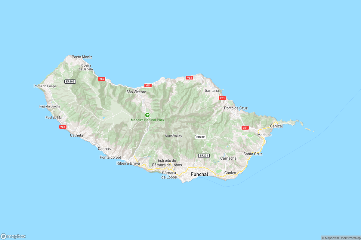
Furado suits walkers who prefer progressing to another place rather than retracing their steps. The tradeoff is transport. Arrange how you will leave Portela before starting at Ribeiro Frio; a car parked at the beginning does not become more conveniently located after five hours of walking.
If you choose to walk only part of the route and return, calculate that version separately. The advertised 11 km refers to the complete one way trail, not an outward and return walk from Ribeiro Frio.
Compare pickup arrangements as carefully as route descriptions. A transfer with a clear meeting point and realistic collection time can be more useful than a cheaper booking that leaves those details unresolved.
Trail Reservations and Entry Fees
For independent visitors in 2026, the standard individual fee for IFCN managed classified trails covered by the charging system, excluding PR1, is €4.50. Children aged 12 and under are exempt from payment, but still require registration and a reservation. The IFCN trail reservation and fee FAQ gives the applicable rules.
Reservations are made online through SIMplifica and are subject to availability. Combined day or multiday pricing does not provide unrestricted access: each intended trail still needs its own reservation. Check the selected trail, date and entry slot before paying.
If booking an organised excursion, ask whether the operator handles the trail reservation and whether admission is included. Keep confirmation available offline, and leave enough time for the journey to the starting point. Avoid booking two walks so closely together that one delay makes the second reservation impractical.
Getting to the Trail and Back
Plan the walking route and transport as one decision. For a return walk, confirm the actual starting point, parking arrangements and any approach on foot. For a one way route, settle the return journey before committing to the hike.
Do not assume that a bus serving a nearby settlement also serves your trail entrance at a useful time. Match the exact stop and timetable to your walk, including a margin for a slower finish. The guide to getting around Madeira compares the transport options.
When considering a guided walk or transfer, ask about pickup locations, walking pace, turnaround points and the procedure if the route closes. For Caldeirão Verde, confirm whether the booking ends at Verde or continues to Inferno. For Furado, confirm that collection is from the finishing point, not the starting point.
What to Carry and When to Turn Back
Choose footwear with dependable grip, and carry waterproof protection, a warm layer, drinking water, food and a charged phone. Add a headlamp for tunnel routes, plus an offline map and a backup power supply where appropriate. Use the Madeira packing list for a fuller checklist without carrying your entire suitcase.
Before departure, check trail notices and the forecast for the walking area rather than relying on conditions at your accommodation. Follow closure barriers and signed restrictions. Do not use another walker continuing ahead as evidence that a closed section is acceptable.
At narrow passages, stop somewhere secure and agree who will pass. Avoid balancing on channel walls to overtake or stepping beyond a barrier for a photograph. If the path, water flow or visibility makes you uncomfortable, turn back while you still have room and time to do so.
For a first visit, choose one shorter walk and one longer route rather than filling every available day with similar outings. Balcões followed on another day by 25 Fontes or Rei makes a sensible starting plan. Add Caldeirão Verde or Furado when their distance, terrain and transport arrangements match the day you actually want.